October 31, 2008

Jewel of the Chugach

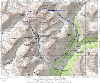
Even when the conditions aren't so great, a skier's lifestyle is the best way for me. Such was the case at Crow Pass. Unable to rally my buddies to the Autumn Jewel, I ran to Girdwood to check it out. Well, it was good exercise and a nice sunny day, but the snow was wind-hammered.
This route can be dangerous. Several years ago, a woman died in an avalanche near the looker's left end of the trail.
The trail wraps around out of view, and up, up, up.

Jewel, the rocky side. At first it's hard to imagine a magnificent snowfield on the other side, but it really is there.
Snow quality has been better there on the other side, but on the typcially boney side (as in the pic), coverage was exceptional for October 31. I was able to ski down to the switchbacks within 500' vertical from the car. More often this time of year, I've found powder on Jewel/Summit, and not enough snow to ski on the Crow Pass Trail. Jewel and Summit Mountains are favorite fall powder stashes joined by a common access, the Crow Pass Trail. When we first skied here, my buddies and I referred to it as October Glacier – not having read the maps, we based our name on the reliable powder that we usually found there. On newer versions of the USGS map, in addition to Jewel Mountain and Summit Mountain, you may find the label, Bahrenberg Mine. While access is long and arduous, the prize is worth the work, usually. There were a couple of track remnants of more fortunate powder seekers, but the snow on this trip was either sastrugi, or breakable crust.
Summit Glacier
Turned around at the toe of the glacier, more breakable crust was evident, and sunset was approaching.
Top of Jewel
The line from the top of Jewel comes from the summit down the picture, and bends to lookers' left behind the cliffs.
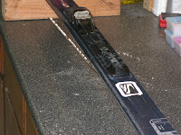
Making a quick trip, I took my light skis. I think I found their limit. This system has held up really well under a lot of stress. But, I hit a rock circumavigating The Pinnacle, and popped the edge out, then cut off about 2", but descending the breakable crust from the toe of the Jewel/Summit Glacier, another 6" of the edge popped out.
October 26, 2008

Microdot Reprise


Kruser rallies and I have to go. The 5" fresh snow of the lowest density, and the weather report of sunny skies and no wind overnight made it a GO.


The snow on the north facing slopes was a "10". Billowing as we descended, the snow just hung in the air like smoke. The base is there, but we couldn't feel it on the descent - it was more like floating. And we even found remnants of our uptrack from last week to make the trail breaking tolerable (after 8 hrs breaking yesterday, we needed it.) No wind, sunny skies, and cold smoke.

A little late on the start, still feeling yesterday's trailbreaking - the downside of loop trips, we made it to Independence at 11:30 and got in 3 Microdot laps before heading home. We had the mountain to ourselves, while dozens of others tracked Skyscraper, Hatch, Government, and Marmot (Fish).


October 25, 2008

The Pinnacle Loop - Talkeetnas


Kruser and yours truly made the Friendship Pass - Fairangel Lakes Loop around The Pinnacle. We skied from Indenpendence to Goldcord on a COLD morning. Skies were clear and as the sun rose and we climbed, we didn't stay cold for long. About 4" fresh had fallen since last week, and making laps on Microdot, Hatch or some other peak was tempting, but we had a plan.

We were planning to circumnavigate The Pinnacle, shown here in the sunshine.


Goldcord


Microdot in the background.


Friendship Pass enjoyed the morning sunshine, but clouds had rolled in by the time we arrived.
Our beautiful sunshine gave way to a storm and not many pictures beyond Friendship Pass.

Here is Kruser in the Fairangel basin. Fairangel Lakes are surrounded by enormous boulders. There are lots of boulder fields in the Talkeetna Mountains, but the Fairangel boulders are super huge, some like a Mack truck.

We couldn't see and the day was getting short, so we skied to the Archangel Road - found it right at the Firn Mine Gate. Skied the Archangel Road (closed to vehicles, but it had a nice ski track.) Then I hitchhiked back to Independence and Kruser skied down to the MotherLode where I picked him up with the car.

A splendid adventure.

October 19, 2008

Microdot


Kruser, MW, and yours truly made the October pilgrimage to Hatcher Pass October 18. Weather was a "10" - brilliant blue skies and nearly no wind. Sun effects on the south sides gave way to hoary crystalline pleasure on the north aspects.
Microdot is just east of the Independence Mine winter parking lot and overlooks the ghost town.

Undecided at the Independence Mine State Park lot, we headed up toward Independence, pondering a tour over Friendship Pass, but finally deciding that Microdot was the peak of choice - a good choice it turned out to be. We made 5 laps on northerly aspects. We scraped a few rocks, but found exceptional coverage for October 18. http://www.dnr.state.ak.us/parks/units/indmine.htm

The day before, 17-Oct, I toured up to the saddle of Friendship Pass and found substantial avalanche debris on the north face of Friendship P. The steep, smooth rock faces above and east of the pass had loaded up and released on the couloir below (our normal ski line!) With suncrust on the south side of Friendship Pass, coupled with the avalanche rubble on our line, we opted for Microdot.


Ski cut the cornice, survived, so we skied it.

Kruser with his cranium protector is ready to test the stability.


Ski ze lac!


MW tests the couloir.


Free the heel and free the mind (and occasionally plant the face.)


Lac du Microdot (aka Goldcord Lake) was stable, too.


Microdot was fabulous. Hoar crystals up to an 1" long had formed on the surface. We enjoyed lots of hoary sloughage on the steeps. Some settlement around boulders on the up track; we ski cut the minor cornices at the entries to our couloirs with no signs of instability. Thanks to Kruser for images.
22 years consecutive months and counting.

October 13, 2008

Arctic Valley

Arctic Valley is such a treasure with its easy access to the alpine country. Arctic Valley snow pack is thin, but if you carefully follow the gullies and swales, it's presently skiable. The most reliable snow is on the lee side of the old T-bar, but much caution is necessary to avoid the rocks.

Sunday, 12-Oct-2008 was one of those Arctic Valley beauties with sunshine and calm air while clouds blanketed Anchorage. No photos, sorry.

Ski to live.

October 7, 2008

More SNOW

Let it snow! 6" accumulation at Stuckagain this morning.
Wax 'em up.

October 3, 2008

October 3 Stuckagain Snow

Snow today at our place at Stuckagain. big wet flakes. Harbinger of a big year?